Subscribe
to receive news by email

Poll
Will the Trump Administration Shift U.S. Policy in Favor of Palestine?
- No (87%)
- Yes (13%)
Copyright © 2026 Arab America
Go topThen and Now: The Silk Road Destinations in the Middle East
By: Lindsey Penn/Arab America Contributing Writer
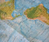
The Silk Road was a major trade route that connected Asia with the Middle East and the edges of North Africa and Europe. Starting in China, merchants would take Chinese textiles (and other goods) all the way from the eastern coast of China, across Central Asia, into Southwest Asia, to the Middle East, and from there, the route went into Byzantium (modern-day Turkey) or Egypt. In total, the land route was about 3,977 miles. The official Silk Road did not go into the Mediterranean Sea, although Egypt and the Byzantine Empire would trade with Europe from there. Trade between China, Central Asia, and the Middle East had already existed for at least 1,000 years, but the Silk Road made the trade route official. People used the route for 1,500 years, starting around 139 BC.
Although modern trade routes have replaced the Silk Road, the destinations along the route continue to be major economic hubs. Below are the cities on the Silk Road trade route in the Middle East, as they were during the Silk Road and now. For the cities in Syria, I included pictures only before the civil war, as now, many of the destinations are rubble. For Mosul, Iraq, I didn’t include current pictures for the same reason.
Tyre, Lebanon
Today a UNESCO World Heritage Site, Tyre is located about 51 miles south of Beirut on the coast of Lebanon. It was the end destination, as the merchants would either load the goods onto a ship to go across the Mediterranean or turn around and head back to China. Tyre is said to be the birthplace of the purple dye, likely one of the many items traded on the Silk Road.
Aleppo, Syria
Aleppo is between the Mediterranean and the Euphrates Valley, giving it a prime position for trade routes. Also a UNESCO World Heritage Site, Aleppo’s souq is famous. Merchants used the souq along the Silk Road. The souq includes over 1,000 stalls and is over 8 miles long.
As I mentioned before, I will not include current pictures of the destinations in Syria because of the ongoing civil war.
Tartus, Syria
Located on the Mediterranean coast of Syria, Tartus is the second-largest port city in Syria. The city’s history goes back to 2000 BC. Similarly to Tyre, Tartus was a major port at the end of the Silk Road for merchants to trade across the Mediterranean.
Homs, Syria
Dating back to 2300 BC, Homs is a strategic city located close to a river and the coast. Because of its location, Homs was the third destination in Syria on the Silk Road, and the path to get to Tartus, Syria, where merchants could trade across the Mediterranean.
Damascus, Syria
Now the capital of Syria, Damascus has a long history and is one of the oldest continuously inhabited cities in the world. The city was famous for trading its dried fruits, almonds, grains, cloth, and steel. It was a stop for merchants and traders to rest before continuing to the Byzantine Empire or going south to the Mediterranean.
Palmyra, Syria
Palmyra was such a big city for the Silk Road because it is surrounded by a desert. It allowed merchants to take the route through the desert instead of around it. For that reason, the city was heavily traveled and has quite a few archaeological sites showing the significance of the caravan city.
Dura Europos, Syria
Dura Europos was one of the first stops in Syria from the Silk Road. The city was founded in around 300 BC. Its prime location close to the Euphrates River allowed the city to have control over the nearby cities and the path of the Silk Road. After the Sasanian Empire conquered the city in 257 AD, the city was abandoned. Archaeologists have excavated much of the city.
Mosul, Iraq
Mosul played a huge role in the Silk Road, especially in the production of silk. At the time of the Silk Road, many of the weavers in Mosul were experts in textiles and created beautiful woven silk garments. The expertise in and production of textiles in Mosul are still very well-known.
Samarra, Iraq
Currently a protected city through UNESCO, Samarra was the second capital of the Abbasid Caliphate. The city is 60 miles north of Baghdad. Samarra grew quickly as a destination on the Silk Road. While it is not the biggest city in Iraq, it is well-known for its history.
Baghdad, Iraq
Baghdad is currently the capital of Iraq. After the city was established, the location on the Silk Road allowed Baghdad to really flourish. It was the most popular for its silk garments, specifically for attabi-style garments. Baghdad developed quickly and contributed quite a bit to the development of all of Iraq.
Ctesiphon, Iraq
Founded during the first century BC, Ctesiphon is an ancient city. Ctesiphon is located on the eastern side of the Tigris River and was a huge trade center. Now, the city is all ruins, as the bricks used to build Ctesiphon were then used to build Baghdad in the 7th century AD. During the Silk Road, Ctesiphon was the stop where the merchants would unload their goods to be sent on a ship on the Tigris River.
Basra, Iraq
As a part of the maritime Silk Road, many Chinese ships would sail to Basra and vice versa. From there, Basra had established a route to Baghdad, where the goods could be traded or sent to the Mediterranean. Basra was also important for silk production, similarly to Baghdad and Mosul.
Check out Arab America’s blog here!